
 |
Menu |  |
|
|
||
 |
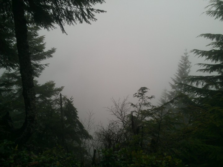
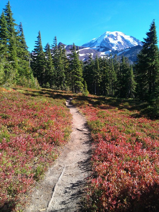
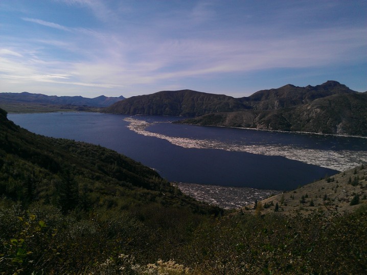
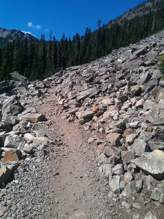
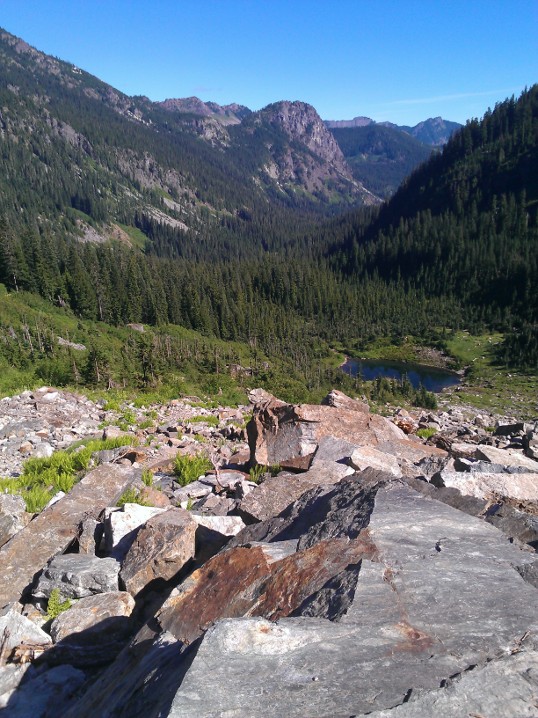
Welcome to UptonArt.netJohn Wayne Trailposted June 2nd, 2013 in Trip reports This is a delayed trip report, by almost a month apparently… I hadn’t been doing much hiking for a couple months and so I forgot to come back and add more posts. I’ve actually been out the John Wayne Trail a few times, both on foot and by bike. It runs along an old railroad grade that has been converted to a hiking/biking(/horse riding, I think) trail that starts across near the Rattlesnake Lake area. Technically, it only starts there in the sense of that’s where the name changes; I think it connects to the Snoqualmie Valley Trail or some other separately maintained biking trail. The first two times I visited it, I walked in with the intent of visiting Cedar Butte, which is accessible by a trail that wanders off through the woods from the main road. The trailhead is poorly marked — and as we have seen multiple times, I’m good at missing trails that leave a main road — so I completely failed to find it the first time. I double-checked the trail description and was able to find it on the second trip, but made the mistake of going on a foggy day in February and was rewarded with basically a flat gray view from the top:
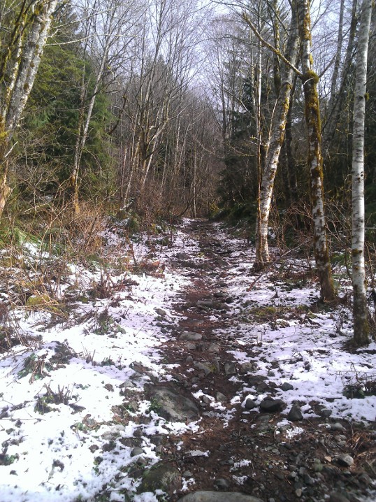
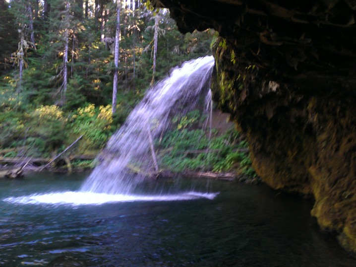
Since then, I made two trips up by bike. My actual goal is to ride back down from Snoqualmie Pass, which is a 25 mile descent, but so far the most I’ve managed is riding about 7 or 8 miles up from Rattlesnake Lake. There are numerous creek crossings and waterfalls, but unfortunately they’re usually relatively deep and steep canyons that I don’t know how I would get out of if I climbed down to the water (to say nothing of the fact that some of them are apparently part of the Seattle water supply and have big “stay away from the water” signs). The most recent trip was also my first experiment with doing video, both real time and time lapse, of a trip. I haven’t edited the real time portion of the ride going up, but here’s a short clip of coming back down (turns out the ~50 minutes of recording on the way up mostly drained the battery): No Comments on John Wayne TrailDirty Harry’s Balcony, sort ofposted March 6th, 2013 in Trip reports Last Sunday, the weather was surprisingly gorgeous in Redmond, so I figured I should take the opporunity to get out and hike a bit. After a bit of searching for a trail that seemed reasonable but that I had not yet hiked on, I settled on Dirty Harry’s Balcony. The trip reports seemed to indicate that I might find some snow on the trail, but the parking lot was at a low enough elevation that I wasn’t worried about wandering off onto hard packed snow in the process (like happened to me a month or so ago while looking for somewhere to pull over and take pictures). So I followed WTA’s instructions to follow the signs toward the WA fire training center, which would go under the freeway and in a quarter mile lead me to a signed gate that said something about closing at 4. Of course, it neglects to point out that there’s another trail head right there, and that as a result there is a decent amount of parking; I had assumed it was just going to be one of the many places here where people end up just parking on the side of the road. That is, assuming I found the right place: the sign said 5:30 instead of 4 as the hard closing time. (Furthermore, it notes that there is no parking along the road for the next couple miles, while WTA seems to imply that you could park on the side of the road if you were okay with potentially getting stuck behind the gate.) I started walking along the road, in search of the “small gravel road/unmarked trailhead” on the right in “about another 0.5 mile[s].” Instead, after something closer to a mile, I think, I found an unmarked trail heading off into the woods that could never have been considered a small gravel road:
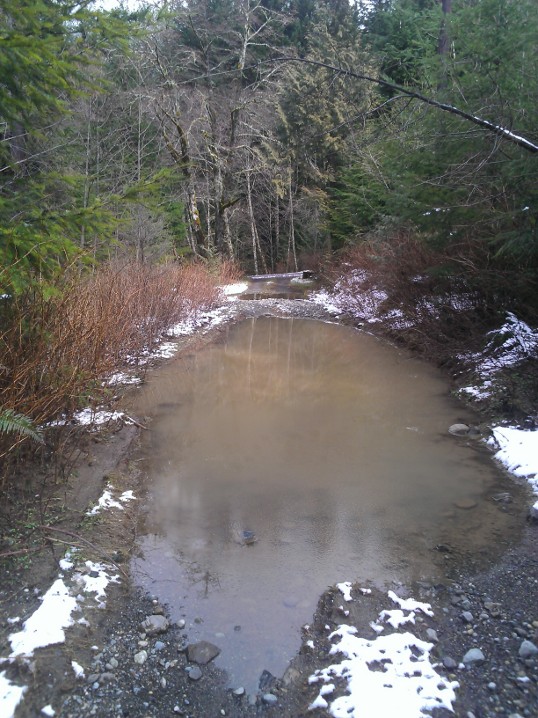
I started up this trail for a while but figured it couldn’t possibly be right, so I exited and continued along the main road. Somewhere around a mile and a half in, I gave up on finding anything matching the description I wanted, but I did find a separate dirt maintenance road off to the left. Since it was a clearing in the trees, it was somewhat more inviting, and I could see some of the mountains like I had hoped to photograph. On the other hand, this disaster of a puddle was somewhat less inviting (picture looking back at the main road after I squeezed around the mess):
I followed this road to its end, in a clearing that would’ve had an excellent view had it not been for the fact the clearing existed only as an open space for power lines to cut through.
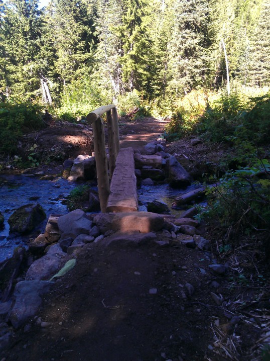
On the way back out, it spit a bit of snow on me, but as I got back to my first trailhead attempt it had let up so I hiked back in a bit to take a few pictures of a cascade I had seen. Of course, that was when it started pouring snow, so I didn’t hang around long. I did meet a couple hiking in who also seemed to think it was the correct trail for Dirty Harry’s Balcony. I still had enough energy to hike up and back, but I wasn’t really equipped to deal with the snow so I bailed out. Maybe next time the weather is nice I will try again. No Comments on Dirty Harry’s Balcony, sort ofMount Rainier Spray Parkposted October 4th, 2012 in Trip reports I decided to get two hikes in this weekend, so for Sunday I headed back out to Mount Rainier to visit Spray Park. I should have visited it much earlier, and in fact I had wanted to but I had misunderstood where it was and thought it was in some remote area on the east side of the park. It turns out it’s in a remote area on the west side of the park, but Google Maps (very incorrectly) assured me it would only take me about an hour and a half to get there. “Very incorrectly,” you say? The approximation is probably okay for about the first 70 minutes of the drive from Redmond, until you pass the little middle of nowhere town called Carbonado. After that, you follow a road down the Carbon River gorge that isn’t too bad, except for a one-lane bridge that could use resurfacing and that probably has such simple direction control because it’s probably relatively rarely used. (As in, there’s a sign that it’s a one way bridge, but it’s basically up to you to creep far enough past the line to see whether anybody is coming toward you, then start across and hope anybody coming the other way does the same to look for you.) But even that’s not so bad; it’s that even though the speed limit is never “officially” lowered from 50mph, shortly after the bridge you get to a fork to continue the remaining 17 miles to the end of the road at Mowich Lake and the Spray Park trail. Unfortunately, only the first two of those miles are paved; the reamaining 15 were paved at one point, I think, but have most recently only had gravel dropped on them. Even that wouldn’t be so bad, but somebody has brought some equipment through that led to most of the 15 miles of road being bumpy much like rumble strips along the side of the highway. So despite the speed limit theoretically being 50, I spent most of the time going about 20 or 25. Amusingly, 4 miles from the end of the road (and one mile inside the park boundary, once you have passed the self-serve pay station), they put a “rough road” sign. Perhaps more amusingly, on the way out, there’s a rough road sign as soon as you exit the park (that also “officially” lowers the speed limit to 25). As if at that point you can do anything about if your car is in no shape to make the remaining 10 mile trip down the bumpy gravel road. Anyway, one thing that’s different about this trail compared to many that I have been on recently is it has a fair amount of up and down. Most of the trails I have hiked recently have been almost entirely up to the destination, or have at least been up to a ridge and then back down, as opposed to consistently alternating between up and down. It also reminded me of hikes in Shenandoah in that you actually start off going down, although not to completely cross a valley so much as just to hook up with a separate trail. It’s basically all through the woods, with the occasional opening and occasional log bridge across a stream.
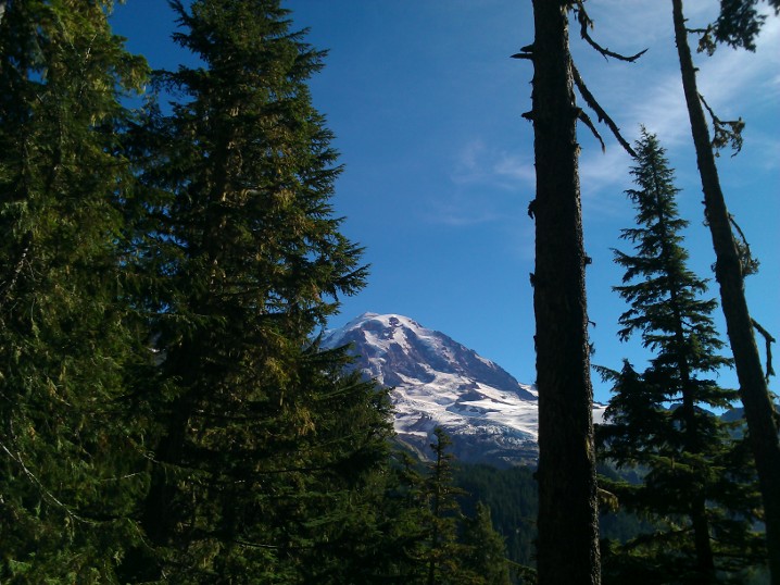
Occasionally, you would catch glimpses of Rainier through the trees.
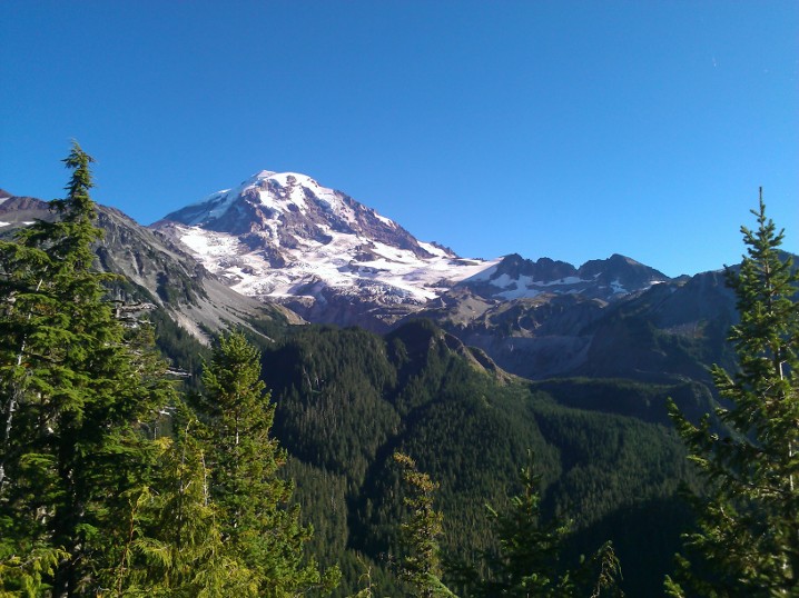
The best view of the mountain from the trail though was from a deck about 100 ft off the trail marked Eagle Point (or something like that):
After about 2 miles, you switch into all-uphill mode, gaining a bit of elevation over the last mile before you reach the entrance to Spray Park proper:
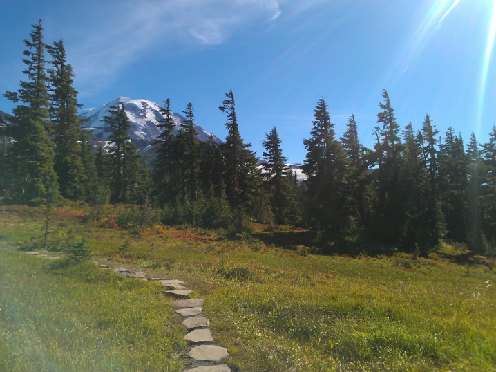
At that point, you basically get to stroll through meadows and around empty snowmelt creek beds, staring up at Rainier the whole time. Had I been here about a month to six weeks ago, I would’ve gotten wildflowers the same as I did at Naches Peak, but I was mostly a bit late.
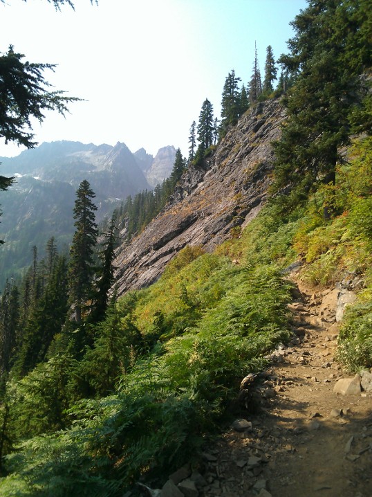
That area of the mountain is divided into a variety of parks (Spray Park, Seattle Park, and some others whose names I don’t know), and another hiker told me that if I continued along the trail I would eventually find myself in another park and then at another parking lot, so I should walk as far as I felt like and then turn around and go back. After exploring another half mile or mile in, I headed back out and spent a bit of time checking out Mowich Lake (which I apparently failed to take any pictures of with my phone). Really, Spray Park is the kind of place you could hang out all day, and I may do it sometime again when I have somebody else to hike out after dark with (and maybe if I take a car out that feels better suited to what amounted to offroading to get there). No Comments on Mount Rainier Spray ParkMount Saint Helens Tripposted October 4th, 2012 in Trip reports I set off last Saturday to visit volcano number two in the state, Mount Saint Helens, and specifically to hike at Norway Pass. The trailhead was about 3 hours from my apartment, and with the hike only being 4.5 miles it was clear that I needed to add something more to the trip to make it worth all the driving time, so I ended up making some other stops. Despite a mostly sunny forecast for the park area, it was dreary for most of the trip and even rainy at times. Once I got farther south, entered the Gifford-Pinchot National Forest, and started to increase in elevation, the clouds eventually mostly cleared. There were several great opportunities for atmospheric shots, or there would have been if there were any places to pull off the road; I would also have had some good chances for shots of clouds nestled in the valleys if the road had not been tree-lined at that point. For my Rattlesnake Ledge hike, I had to complain about hiker etiquette, and for this trip I guess I have to complain about park driver etiquette. I get it, maybe you’re just out for a nice drive through the forest, or aren’t sure where you’re going, but that doesn’t make it okay to drive 10 or 15 under the limit and repeatedly fail to use pullouts to faster people go by. The route to the trailhead is a series of national forest roads, and they’re only moderately well-maintained. The last road out to the trail in fact was partly grown over, in the sense that bushes are growing pretty much unchecked along the road and sprawling out into it. On the other hand, most of the area around the volcano is pretty desolate after the blast in 1980, so maybe they figure it’s better to let things grow back anyway. The trail itself has a warning as you enter that you should bring plenty of water because it’s a dry trail. I guess if you wanted to, you could add an extra mile or so and stroll down to Spirit Lake, but other than that the only water I actually saw along the trail was a fairly stagnant pool in a stream. (I say that I saw because I definitely heard a waterfall somewhere, but I have no idea where.) The bottom of the trail is pretty sandy and makes walking a bit frustrating, kind of like walking along the beach, but it eventually turns into more of just a well-beaten dusty path. The trail forks in several places and unfortunately the destination of Norway Pass is not actually on any of the signs, but I had looked in advance (and some other hikers were able to confirm to me) that I just wanted to stay on Boundary Trail #1. At some points, you could see Mount Rainier peaking out from behind other mountains, although eventually it collected some clouds and went into hiding.
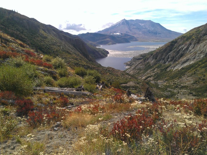
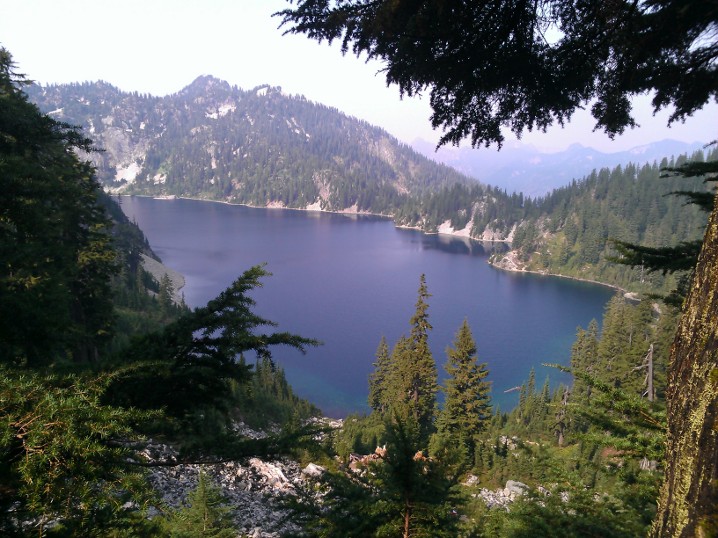
The arrival at the pass is somewhat underwhelming, because it’s just a fork where you can continue along the Boundary Trail #1 to some other trails, or theoretically fork to another trail that was currently closed due to washouts. But if you continue another hundred feet or so, you get a nice view of Spirit Lake and Mount Saint Helens.
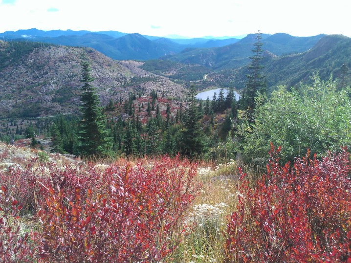
On the way back, some other hikers showed me the huckleberry bushes, which I knew were around and ripe but I had previously not known how to identify, so I got to snack on berries on the way back down. As you come back down the trail, you get a nice view of some of the smaller mountains in the area, as well as Meta Lake.
After finishing up there, I decided to drive out to Windy Ridge, because I was under the (incorrect) impression that it had a visitor center. What it does have is a couple hundred feet of stairs up to an observation deck on the ridge, which gives you another nice view of Spirit Lake and the volcano.
The actual visitor center was on my way back at a place called Cascade Peaks, where I found out the visitor center was closed for the season. It’s okay, park service, it’s not like I wanted to buy a post card or anything. As I headed out of the park and back into national forest land, I stopped at Iron Creek Falls. I had read about it before leaving and the webpage mentioned that the lighting was funky in the afternoon so it was better to stop in the morning, and so that’s what I had planned to do. Unfortunately, the signage was a bit confusing. Normally, I’m used to seeing a notice of a trail head or attraction at least a little in advance, so when I saw the sign that said “Iron Creek Falls 500 ft” with a left arrow, I figured it meant the parking lot was in 500 feet. There was no such thing, so I just continued on to Norway Pass. It turns out that sign was at the end of the parking lot (which I hadn’t noticed because I was just looking for a sign), and the sign actually was pointing to the trail and saying the waterfall was 500 ft down the trail.
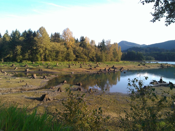
On the way back, I stopped at a park I had driven by several times that is unlabeled on Google Maps or Bing Maps but I believe is called Sun Point Park. What had always drawn me to it, despite the fact I had never stopped before, is the collection of giant tree stumps along the lake shore. I chatted with another photographer there and he mentioned that they were remnants of trees that had probably been cut down 80 or 90 years ago and that you get different scenes depending on the water level of the lake. (The lake must get up much higher than what it was that day, because the whole area was very wet, squishy mud.)
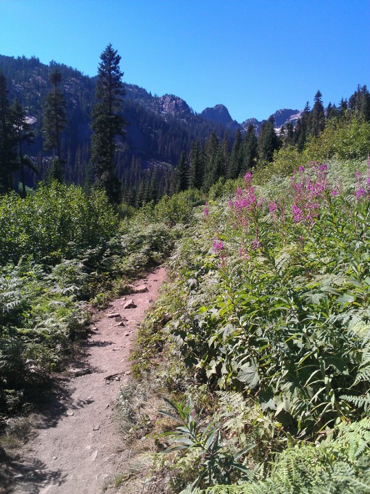
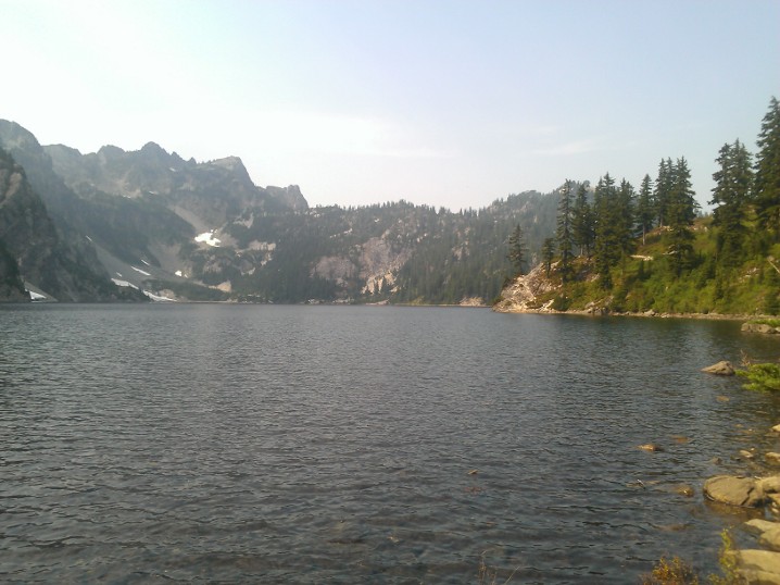
I had intended to come straight home after that, but I ended up stopping at a little roadside pullout north of Eatonville that i had again driven past several times before — it said something about it being a historical marker as well as a scenic view. I didn’t see what the marker was, but it has an unobstructed view of Rainier and so I got to watch the sunset light up the mountain. No Comments on Mount Saint Helens TripSource Lake and Snow Lakeposted September 24th, 2012 in Trip reports This is actually a combined trip report, one from today and one from three weeks ago. It’s not as completely random as it sounds, though, because both Source Lake and Snow Lake are a part of the Alpine Lakes Wilderness. My snowboard teacher had been recommending them both to me, so I finally decided to check them out. Conveniently, there’s a huge amount of parking at the trailhead, since it shares a parking lot with the Alpental ski area. First, three weeks ago, I visited Source Lake, so named as the source of the South Fork of the Snoqualmie River. (The river must have a great many tributaries, given the amount of water in the lake compared to the amount of water other places I’ve been along the South Fork.) The hike is fairly easy, with maybe one or two steep parts but mostly a gentle climb. When I hiked there, about the only wildflowers remaining were some fireweed along the trail closer to the beginning. Most of the hike is exposed, either along the side of the mountain or along some boulder slides.
I wanted to go play on the one remaining snow pile near the lake, but I couldn’t find a good way to get to it. It was a reasonably easy hike up to there, so I thought about continuing on to Snow Lake, but decided I should stick to the hiking plan people knew about instead of continuing on. Instead, I made it out today, since it was a much nicer weather day than yesterday. The trail follows the same trail as Source Lake for about the first two miles (okay, technically, it’s the other way around; it’s the Snow Lake trail, and the trail to Source Lake spurs off of it), and then it starts to switch back and forth up about another 4-500 feet over another mile. You hit a ridge and then descend 350 feet, give or take, down to the lake shore. I finished the stroll down to the lake behind a group of 4 other people, one of whom decided “snow” meant she should sing Christmas carols. After one of the other girls in the party said, “No carols until November,” she switched to random pop songs. Someone then wondered aloud how many people had taken to the wilderness to get away from “people like her;” the guy hiking (separately) in front of them raised his hand. I bumped into one of my coworkers on the way up the trail, and he remarked that the lake was a zoo; even given the number of people I passed exiting as I was going in, it was still pretty popular mid afternoon. On the other hand, it’s a big area, so it didn’t feel that crowded or loud — at least, until two groups’ dogs decided they couldn’t swim in the same part of the lake and instead should bark at each other. I continued along the trail for a while to get to some rock outcroppings, but then turned around before I tried to find my way all the way to the opposite end of the lake.
|
 |
Recent |  |