
 |
Menu |  |
|
|
||
 |
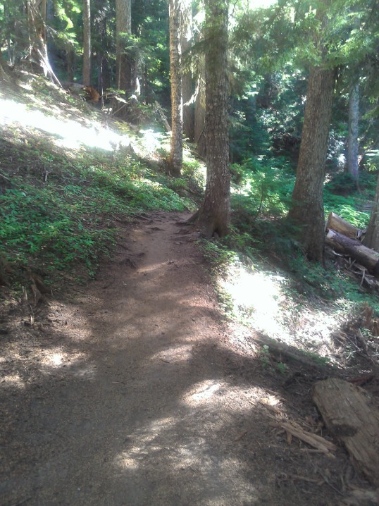
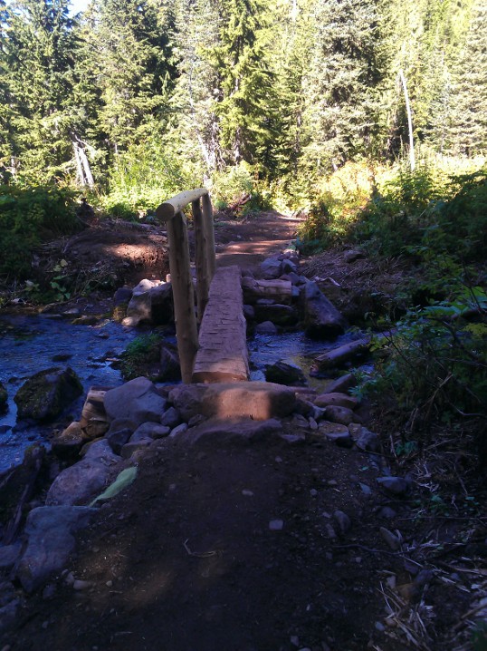
Welcome to UptonArt.netMount Rainier Spray Parkposted October 4th, 2012 in Trip reports I decided to get two hikes in this weekend, so for Sunday I headed back out to Mount Rainier to visit Spray Park. I should have visited it much earlier, and in fact I had wanted to but I had misunderstood where it was and thought it was in some remote area on the east side of the park. It turns out it’s in a remote area on the west side of the park, but Google Maps (very incorrectly) assured me it would only take me about an hour and a half to get there. “Very incorrectly,” you say? The approximation is probably okay for about the first 70 minutes of the drive from Redmond, until you pass the little middle of nowhere town called Carbonado. After that, you follow a road down the Carbon River gorge that isn’t too bad, except for a one-lane bridge that could use resurfacing and that probably has such simple direction control because it’s probably relatively rarely used. (As in, there’s a sign that it’s a one way bridge, but it’s basically up to you to creep far enough past the line to see whether anybody is coming toward you, then start across and hope anybody coming the other way does the same to look for you.) But even that’s not so bad; it’s that even though the speed limit is never “officially” lowered from 50mph, shortly after the bridge you get to a fork to continue the remaining 17 miles to the end of the road at Mowich Lake and the Spray Park trail. Unfortunately, only the first two of those miles are paved; the reamaining 15 were paved at one point, I think, but have most recently only had gravel dropped on them. Even that wouldn’t be so bad, but somebody has brought some equipment through that led to most of the 15 miles of road being bumpy much like rumble strips along the side of the highway. So despite the speed limit theoretically being 50, I spent most of the time going about 20 or 25. Amusingly, 4 miles from the end of the road (and one mile inside the park boundary, once you have passed the self-serve pay station), they put a “rough road” sign. Perhaps more amusingly, on the way out, there’s a rough road sign as soon as you exit the park (that also “officially” lowers the speed limit to 25). As if at that point you can do anything about if your car is in no shape to make the remaining 10 mile trip down the bumpy gravel road. Anyway, one thing that’s different about this trail compared to many that I have been on recently is it has a fair amount of up and down. Most of the trails I have hiked recently have been almost entirely up to the destination, or have at least been up to a ridge and then back down, as opposed to consistently alternating between up and down. It also reminded me of hikes in Shenandoah in that you actually start off going down, although not to completely cross a valley so much as just to hook up with a separate trail. It’s basically all through the woods, with the occasional opening and occasional log bridge across a stream.
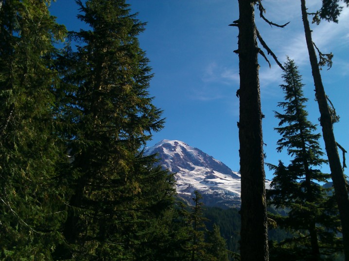
Occasionally, you would catch glimpses of Rainier through the trees.
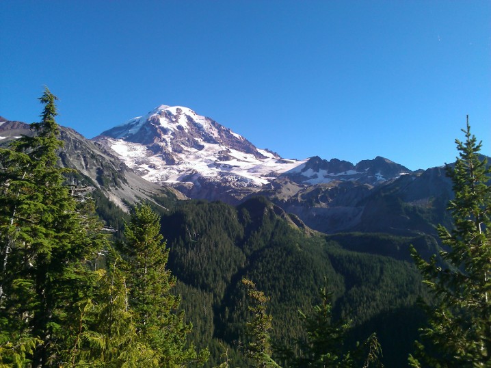
The best view of the mountain from the trail though was from a deck about 100 ft off the trail marked Eagle Point (or something like that):
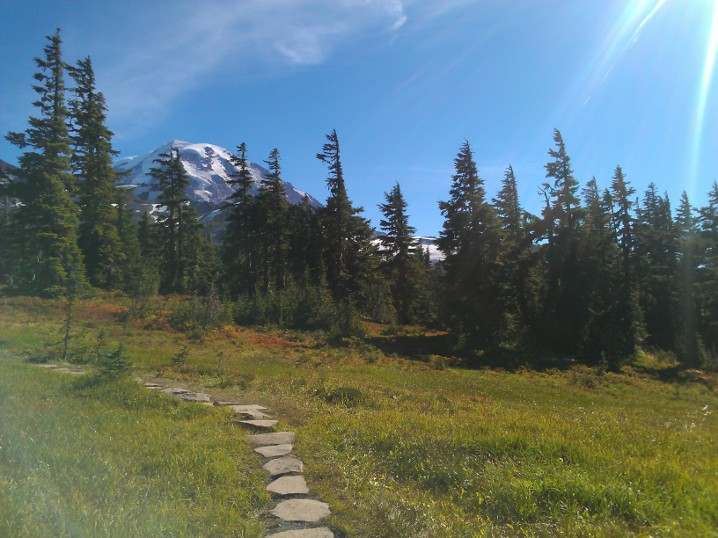
After about 2 miles, you switch into all-uphill mode, gaining a bit of elevation over the last mile before you reach the entrance to Spray Park proper:
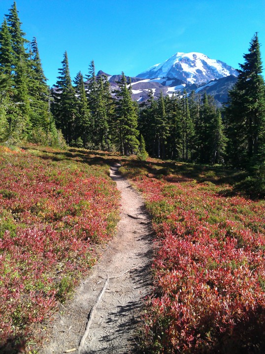
At that point, you basically get to stroll through meadows and around empty snowmelt creek beds, staring up at Rainier the whole time. Had I been here about a month to six weeks ago, I would’ve gotten wildflowers the same as I did at Naches Peak, but I was mostly a bit late.
That area of the mountain is divided into a variety of parks (Spray Park, Seattle Park, and some others whose names I don’t know), and another hiker told me that if I continued along the trail I would eventually find myself in another park and then at another parking lot, so I should walk as far as I felt like and then turn around and go back. After exploring another half mile or mile in, I headed back out and spent a bit of time checking out Mowich Lake (which I apparently failed to take any pictures of with my phone). Really, Spray Park is the kind of place you could hang out all day, and I may do it sometime again when I have somebody else to hike out after dark with (and maybe if I take a car out that feels better suited to what amounted to offroading to get there). No Comments on Mount Rainier Spray Park
|
 |
Recent |  |
Leave a Reply