
 |
Menu |  |
|
|
||
 |
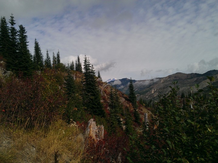
Welcome to UptonArt.netMount Saint Helens Tripposted October 4th, 2012 in Trip reports I set off last Saturday to visit volcano number two in the state, Mount Saint Helens, and specifically to hike at Norway Pass. The trailhead was about 3 hours from my apartment, and with the hike only being 4.5 miles it was clear that I needed to add something more to the trip to make it worth all the driving time, so I ended up making some other stops. Despite a mostly sunny forecast for the park area, it was dreary for most of the trip and even rainy at times. Once I got farther south, entered the Gifford-Pinchot National Forest, and started to increase in elevation, the clouds eventually mostly cleared. There were several great opportunities for atmospheric shots, or there would have been if there were any places to pull off the road; I would also have had some good chances for shots of clouds nestled in the valleys if the road had not been tree-lined at that point. For my Rattlesnake Ledge hike, I had to complain about hiker etiquette, and for this trip I guess I have to complain about park driver etiquette. I get it, maybe you’re just out for a nice drive through the forest, or aren’t sure where you’re going, but that doesn’t make it okay to drive 10 or 15 under the limit and repeatedly fail to use pullouts to faster people go by. The route to the trailhead is a series of national forest roads, and they’re only moderately well-maintained. The last road out to the trail in fact was partly grown over, in the sense that bushes are growing pretty much unchecked along the road and sprawling out into it. On the other hand, most of the area around the volcano is pretty desolate after the blast in 1980, so maybe they figure it’s better to let things grow back anyway. The trail itself has a warning as you enter that you should bring plenty of water because it’s a dry trail. I guess if you wanted to, you could add an extra mile or so and stroll down to Spirit Lake, but other than that the only water I actually saw along the trail was a fairly stagnant pool in a stream. (I say that I saw because I definitely heard a waterfall somewhere, but I have no idea where.) The bottom of the trail is pretty sandy and makes walking a bit frustrating, kind of like walking along the beach, but it eventually turns into more of just a well-beaten dusty path. The trail forks in several places and unfortunately the destination of Norway Pass is not actually on any of the signs, but I had looked in advance (and some other hikers were able to confirm to me) that I just wanted to stay on Boundary Trail #1. At some points, you could see Mount Rainier peaking out from behind other mountains, although eventually it collected some clouds and went into hiding.
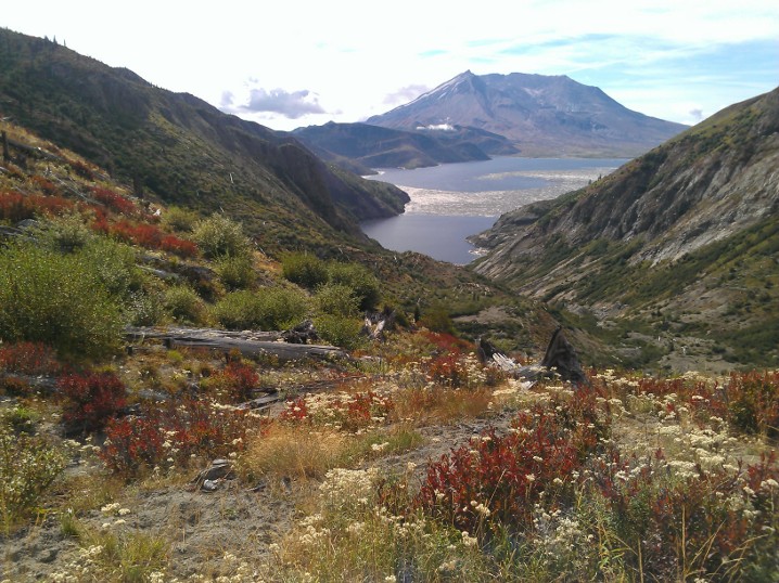
The arrival at the pass is somewhat underwhelming, because it’s just a fork where you can continue along the Boundary Trail #1 to some other trails, or theoretically fork to another trail that was currently closed due to washouts. But if you continue another hundred feet or so, you get a nice view of Spirit Lake and Mount Saint Helens.
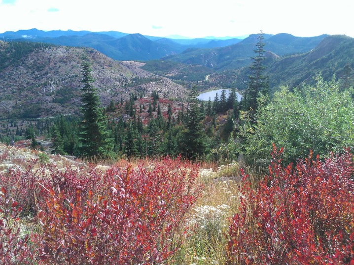
On the way back, some other hikers showed me the huckleberry bushes, which I knew were around and ripe but I had previously not known how to identify, so I got to snack on berries on the way back down. As you come back down the trail, you get a nice view of some of the smaller mountains in the area, as well as Meta Lake.
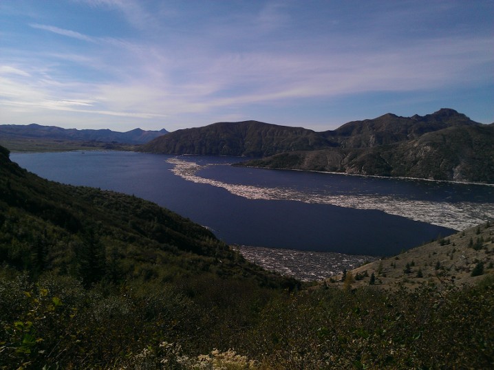
After finishing up there, I decided to drive out to Windy Ridge, because I was under the (incorrect) impression that it had a visitor center. What it does have is a couple hundred feet of stairs up to an observation deck on the ridge, which gives you another nice view of Spirit Lake and the volcano.
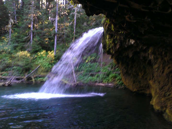
The actual visitor center was on my way back at a place called Cascade Peaks, where I found out the visitor center was closed for the season. It’s okay, park service, it’s not like I wanted to buy a post card or anything. As I headed out of the park and back into national forest land, I stopped at Iron Creek Falls. I had read about it before leaving and the webpage mentioned that the lighting was funky in the afternoon so it was better to stop in the morning, and so that’s what I had planned to do. Unfortunately, the signage was a bit confusing. Normally, I’m used to seeing a notice of a trail head or attraction at least a little in advance, so when I saw the sign that said “Iron Creek Falls 500 ft” with a left arrow, I figured it meant the parking lot was in 500 feet. There was no such thing, so I just continued on to Norway Pass. It turns out that sign was at the end of the parking lot (which I hadn’t noticed because I was just looking for a sign), and the sign actually was pointing to the trail and saying the waterfall was 500 ft down the trail.
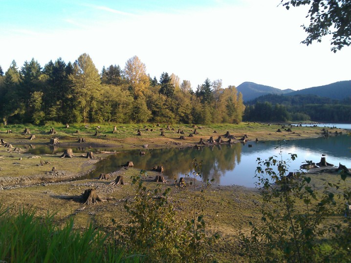
On the way back, I stopped at a park I had driven by several times that is unlabeled on Google Maps or Bing Maps but I believe is called Sun Point Park. What had always drawn me to it, despite the fact I had never stopped before, is the collection of giant tree stumps along the lake shore. I chatted with another photographer there and he mentioned that they were remnants of trees that had probably been cut down 80 or 90 years ago and that you get different scenes depending on the water level of the lake. (The lake must get up much higher than what it was that day, because the whole area was very wet, squishy mud.)
I had intended to come straight home after that, but I ended up stopping at a little roadside pullout north of Eatonville that i had again driven past several times before — it said something about it being a historical marker as well as a scenic view. I didn’t see what the marker was, but it has an unobstructed view of Rainier and so I got to watch the sunset light up the mountain. No Comments on Mount Saint Helens Trip
|
 |
Recent |  |
Leave a Reply