
 |
Menu |  |
|
|
||
 |
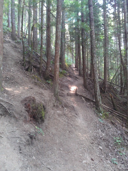
Welcome to UptonArt.netMailbox Peak hikeposted August 19th, 2012 in Trip reports As I continue to, er, not update the theme or upload my photos, I figured I should add other content. So, trip reports! Hiking, driving (whenever I have another one of those), whatever. Today I hiked Mailbox Peak. I’d heard it was a rite of passage of sorts for hiking around the Cascades, so I figured that was a good one to bump up the difficult level a bit. “A bit.” As the link above mentions, this is intense. I tracked it with my Fitbit and it’s not clear whether the Fitbit’s altimeter is finicky at higher elevations or if the WTA description is wrong — it claims 4100 feet elevation gain, but I “only” hit 3500 on my way to the top. Over the course of 3 miles, plus or minus, that’s pretty steep either way. I’d actually tried last week, but I missed the trailhead and hiked around on a fire road for a while, and by the time I figured out where I’d gone wrong I was too tired to start the proper trail. The first part of the trail is lower in the forest and, although it mostly keeps with the focus of getting as much elevation as quickly as possible, it does have a few switchbacks and is fairly well marked. Around 1500 feet up from the parking lot, white diamonds as trail markers start showing up on trees, frequently with inspirational messages of sorts (“Pain is weakness leaving the body,” “How high can you fly?,” “You only fail if you give up”).
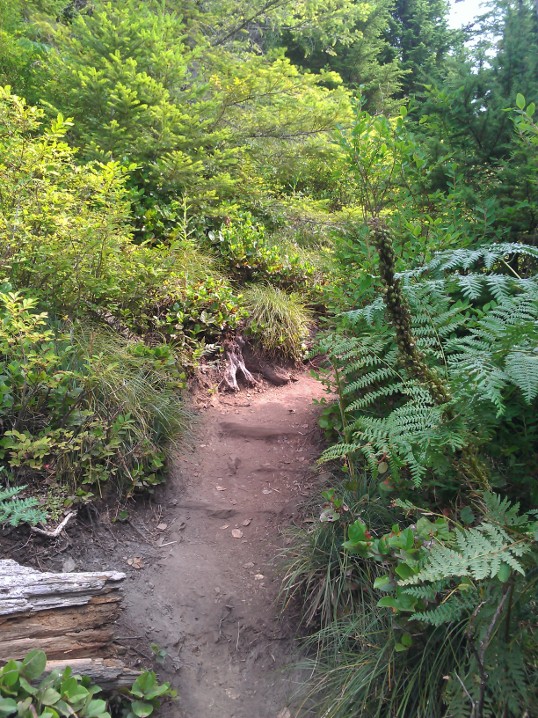
Around 2000 feet up, there are two big changes: the commentary on the trail markers disappears, and the trail markers become basically the only way to figure out where you’re going. Sure, there are rough trails kicked in by use, but the trail at this point is basically “dirt and roots that are slightly more packed than the surrounding dirt and roots.” Somewhere around 2500 feet up, it changes from older growth to newer growth forest, with shorter trees and generally much more open. This is also where you first start to get views of the I-90 corridor and Issaquah locally, and Mount Rainier further off to the south.
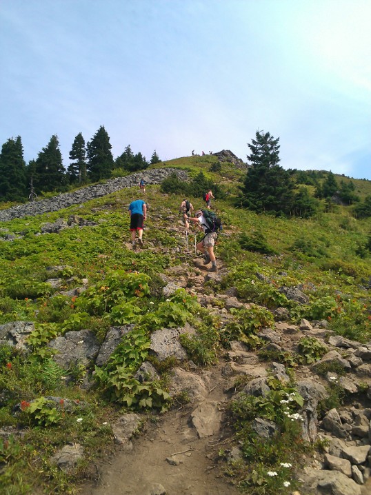
At 3000 feet, you get to make a choice: Continue through more dense woods, or scramble up a boulder field. A sign at the bottom of the trail warns that people not-infrequently get lost coming back down while trying to avoid the boulder field, so I joined another guy who reached the boulders at about the same time I did and we went straight up the rocks. It was actually one of the easier sections of the trail…but it was also a bit of a tease. The other guy seemed to think that the boulder scramble was the end, so of course he was disappointed; I knew better, but the trail seemed to get even steeper for the last few hundred feet of elevation gain.
Coming back down: I have no idea how people get lost on the way down. Maybe they’ve put in new signage because of the problems, but the trail at that point is fairly well marked (including giant burnt wood signs that say “Trailhead” and have an arrow) without anything that would encourage a hiker to head off in another direction. But either way, after slogging 3 miles up something that steep, my legs were pretty tired, and it actually takes a fair amount of effort to come back down as well — both due to slowing yourself down on the steep trail, and keeping traction despite lots of loose rocks even in the deep forested section. Also: Lesson learned, carry more water than you think you need. I was fine for food (a peanut butter & jelly sandwich and two Clif bars, plus one in reserve), but even on a mild day I had to ration water. Ironically, I was much better prepared in terms of water for last week’s aborted attempt. I didn’t take my DSLR because I didn’t want to add any more weight than necessary, and the point & shoot I had grabbed decided to give up halfway through summit pictures (not surprising; it had been totally busted and I barely managed to fix it in the first place), so basically all I had were cell phone photos. Oh well. You could only kind of see Mount Rainier and Mount Baker, anyway. No Comments on Mailbox Peak hike
|
 |
Recent |  |
Leave a Reply