
 |
Menu |  |
|
|
||
 |
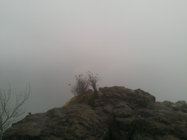
Welcome to UptonArt.netRattlesnake Ledge, reduxposted September 23rd, 2012 in Trip reports I decided yesterday that I should go hiking somewhere, partly because I’m rapidly running out of “good” weekends to hike and partly to start to scope out the foliage in the area. I didn’t make this decision until fairly late in the afternoon though, which limited my options to somewhere fairly close by and not too long. I decided I would give Rattlesnake Ledge another go — I’d hiked it back around early March and got rained/sleeted/snowed on, so it couldn’t be any worse. It wasn’t much better, either, except for being about 15 or 20 degrees warmer. I woke to rain in Redmond, but by the afternoon it had started to clear up enough that I could at least see some blue in the sky. As it turns out, the clouds had not blown away as much over around North Bend. It misted and sprinkled on me on the way up, along with rain falling off of the trees, but nothing heavy. When I got to the top, it was still completely wrapped in fog:
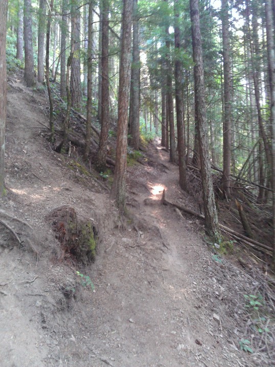
…although the fog did lift enough to see back down to the lake before I left. There were a couple squirrels and one chipmunk running around begging food from the other hikers; even on a lousy weather day, it was a fairly popular hike. The worst of the hike was a group of people who haven’t been lectured enough on trail etiquette, which I guess is a downside of hiking a popular, accessible, “relatively” easy trail. It’s a fairly narrow trail for most of the hike, which means there are not many good places to pass; I got stuck behind a group of three people walking in a V formation to take up the whole trail. They looked back at me several times and showed no interest in forming into a single line or pulling over to the side to let me by. Oh well, I eventually found a way past them, sped on to the top, and passed them about a quarter mile from the top as I was heading back down. No Comments on Rattlesnake Ledge, reduxNaches Peak Loop/Tipsoo Lakeposted September 6th, 2012 in Trip reports I’d been planning on waiting until I had some pictures ready to go up with this one, since it was very much a photography hike, but apparently my hard drive is like purgatory for pictures. The last weekend of August I made my way up to Tipsoo Lake and the Naches Peak loop trail, which is “sort of” in Mount Rainier National Park. I think the trailhead technically is in the park, but not in a section where they actually enforce an entry fee. Parts of the hike then cross the Snoqualmie National Forest and maybe one other National Forest area. The trail goes along part of the Pacific Crest Trail, so now I can say I’ve “started” two of the three trails on the Triple Crown of Hiking, and two of the four long trails that I think I would like to do. (I’ve hiked bits and pieces of the Appalachian Trail, of course, in VA; the other two are the Continental Divide Trail, which I think I have missed both times I’ve been in its general vicinity, and the John Muir Trail in the Sierra Nevada range.) I actually could’ve gotten in more of the PCT while I was out that day, but it would’ve added three miles to the hike. On its own, that wouldn’t have been bad, but it would have started off going downhill toward Dewey Lake, and I had no idea how steep it was. As a result, I wasn’t sure how long it would take, and I thought I might start to run short on daylight if it took too long. In short: despite the huge number of people and accompanying nightmarish parking situation, this is definitely a hike worth doing. After all, there must be a reason everyone else was there, right? It’s a fairly easy stroll, as the WTA guide notes, without any long steep sections. The first half heads east and then south around Naches Peak at ~6400 ft, with a couple short gains but mostly rolling up and downhill along the rocks. Then you turn west to return to the parking lot and you basically spend your time walking through meadows full of wildflowers and staring at Mount Rainier. I think I heard a ranger say there would be flowers for another week or two and then it would quickly transition to fall colors, so I might have to head up again soon. No Comments on Naches Peak Loop/Tipsoo LakeMailbox Peak hikeposted August 19th, 2012 in Trip reports As I continue to, er, not update the theme or upload my photos, I figured I should add other content. So, trip reports! Hiking, driving (whenever I have another one of those), whatever. Today I hiked Mailbox Peak. I’d heard it was a rite of passage of sorts for hiking around the Cascades, so I figured that was a good one to bump up the difficult level a bit. “A bit.” As the link above mentions, this is intense. I tracked it with my Fitbit and it’s not clear whether the Fitbit’s altimeter is finicky at higher elevations or if the WTA description is wrong — it claims 4100 feet elevation gain, but I “only” hit 3500 on my way to the top. Over the course of 3 miles, plus or minus, that’s pretty steep either way. I’d actually tried last week, but I missed the trailhead and hiked around on a fire road for a while, and by the time I figured out where I’d gone wrong I was too tired to start the proper trail. The first part of the trail is lower in the forest and, although it mostly keeps with the focus of getting as much elevation as quickly as possible, it does have a few switchbacks and is fairly well marked. Around 1500 feet up from the parking lot, white diamonds as trail markers start showing up on trees, frequently with inspirational messages of sorts (“Pain is weakness leaving the body,” “How high can you fly?,” “You only fail if you give up”).
Around 2000 feet up, there are two big changes: the commentary on the trail markers disappears, and the trail markers become basically the only way to figure out where you’re going. Sure, there are rough trails kicked in by use, but the trail at this point is basically “dirt and roots that are slightly more packed than the surrounding dirt and roots.” Somewhere around 2500 feet up, it changes from older growth to newer growth forest, with shorter trees and generally much more open. This is also where you first start to get views of the I-90 corridor and Issaquah locally, and Mount Rainier further off to the south.
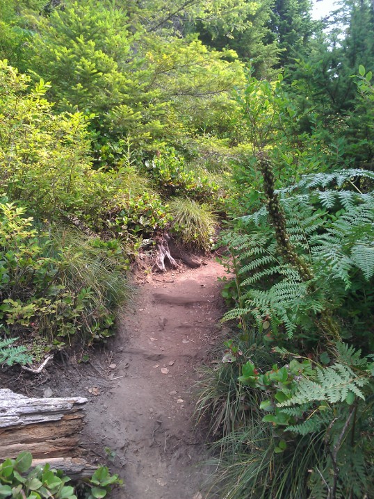
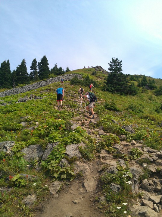
At 3000 feet, you get to make a choice: Continue through more dense woods, or scramble up a boulder field. A sign at the bottom of the trail warns that people not-infrequently get lost coming back down while trying to avoid the boulder field, so I joined another guy who reached the boulders at about the same time I did and we went straight up the rocks. It was actually one of the easier sections of the trail…but it was also a bit of a tease. The other guy seemed to think that the boulder scramble was the end, so of course he was disappointed; I knew better, but the trail seemed to get even steeper for the last few hundred feet of elevation gain.
Coming back down: I have no idea how people get lost on the way down. Maybe they’ve put in new signage because of the problems, but the trail at that point is fairly well marked (including giant burnt wood signs that say “Trailhead” and have an arrow) without anything that would encourage a hiker to head off in another direction. But either way, after slogging 3 miles up something that steep, my legs were pretty tired, and it actually takes a fair amount of effort to come back down as well — both due to slowing yourself down on the steep trail, and keeping traction despite lots of loose rocks even in the deep forested section. Also: Lesson learned, carry more water than you think you need. I was fine for food (a peanut butter & jelly sandwich and two Clif bars, plus one in reserve), but even on a mild day I had to ration water. Ironically, I was much better prepared in terms of water for last week’s aborted attempt. I didn’t take my DSLR because I didn’t want to add any more weight than necessary, and the point & shoot I had grabbed decided to give up halfway through summit pictures (not surprising; it had been totally busted and I barely managed to fix it in the first place), so basically all I had were cell phone photos. Oh well. You could only kind of see Mount Rainier and Mount Baker, anyway. No Comments on Mailbox Peak hike |
 |
Recent |  |